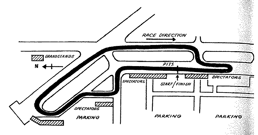
The map presently available appears to be of the 2.2 mile
course used from 1956 through 1960:
A 2.9 mile course was used from April 16th, 1950 through 1952. A 2 mile course was used on March 21st, 1953. A 2.6 mile course was used on March 22nd, 1953 through 1955. A 2.2 mile course was used from December 3rd, 1956 through late January of 1960. A 2.15 mile course was used from 1989 through 1998.
', reference1=>'AmericasSpeedways', reference1pages=>'154', weatherID => '', weatherZIP => '', officialWebSite => '', schedulePage => '', resultsPage => '', ticketsPage => '', gettingThere => '', racersGuide => '', hotLap => '', workersGuide => '', foodInsert => '', hotelInsert => '', TOCInsertLink1 => '', TOCInsertText1 => '', TOCInsertLink2 => '', TOCInsertText2 => '', TOCInsertLink3 => '', TOCInsertText3 => '', TOCInsertLink4 => '', TOCInsertText4 => '', TOCInsertLink5 => '', TOCInsertText5 => '', TOCInsertLink6 => '', TOCInsertText6 => '', offsiteTOCInsertLink1 => '', offsiteTOCInsertText1 => '', offsiteTOCInsertLink2 => '', offsiteTOCInsertText2 => '', offsiteTOCInsertLink3 => '', offsiteTOCInsertText3 => '', offsiteTOCInsertLink4 => '', offsiteTOCInsertText4 => '', offsiteTOCInsertLink5 => '', offsiteTOCInsertText5 => '', offsiteTOCInsertLink6 => '', offsiteTOCInsertText6 => '', &>