





![]](/images/rtend.jpg)
New: Last Updated: 2007-06-09
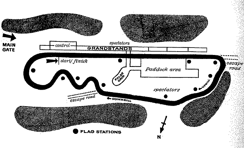
Vineland Speedway was a 1.5 mile road course, 1/2 mile paved oval, and a drag strip, located near Vineland, New Jersey.
Signifcant portions of the facility are still somewhat intact, and locals have been known to "take laps" on it.
Thanks to Alan Moore for the precise location data.
Elevation: 65 feet
Latitude: 39.437187
Longitude: -75.050097Time zone: EST/EDT (-0500/-0400)A 1/2 mile dirt oval operated from April 3rd, 1955 through October 20th, 1957. A 1/10th mile dirt oval operated briefly in 1956. The 1/2 mile oval was paved from April 12th, 1958 through July 30th, 1965. A 1/4 mile dragstrip operated from August 2nd, 1958 through 1967; it used the front straight of the oval. A 1.5 mile road course operated from October 26th, 1958 through 1966. It used the dragstrip, return roads, and part of the oval.
| Allan E. Brown,The History of America's Speedways: Past & Present.Comstock Park, MichiganBrown,2003, ISBN 0931105617, pp. 467. |
The road course map presently available is:
For information on how these aerial images work, Click Here.