Riverside has long since been converted to a shopping mall and housing.
Thanks to William Waters for the scans of Cal Club documents.
', trackOffice => '
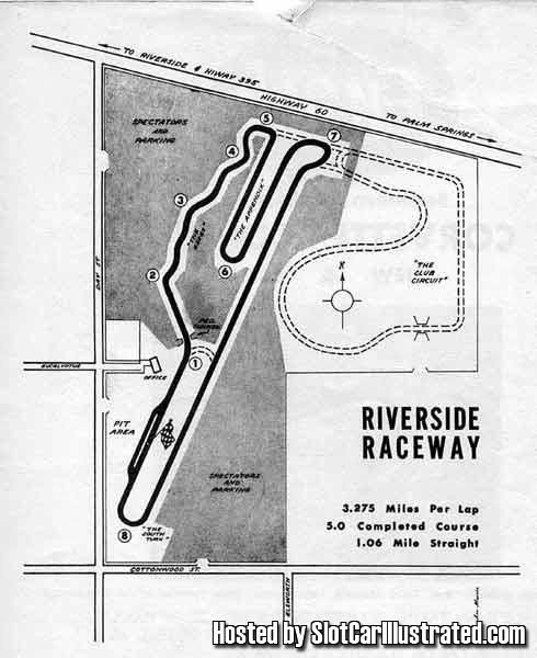
The first map dates from around 1956
(before the track opened)
and shows the proposed but never
paved club course option on the right upper side.
This map is not to scale, and the club course that was bulldozed
differs a bit from the illustration.
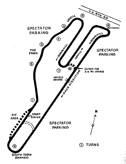
The next map dates from about 1962, and shows the original turns 1 and
9, the oval, the pits on the outside of the track,
and the generally more limited set of options that were in use at the
time.
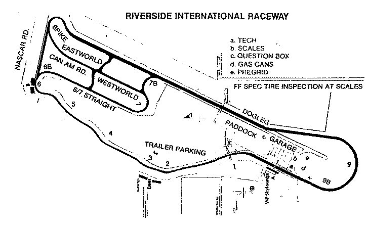
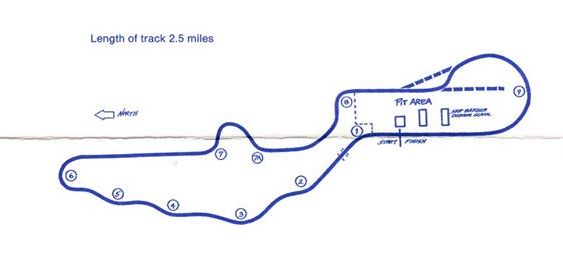
This map dates from the mid 80s, and shows a variety of options
and the final version of turn 9.
The map shows the options added by CalClub around 1980 as
Eastworld and Westworld, but CalClub members who raced and worked there
in the period state that it was Eastline, not Eastworld.
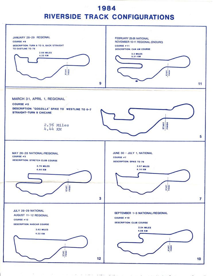
This set of maps dates from 1984, and shows the variants that CalClub
used for their race series that year.
This map shows the abbreviated configuration used by CalClub in 1989,
the year the track operated as Riverside Regional Raceway.
The road course opened on September 21st, 1957, and operated until 1988. The original proposal included a Club Circuit on the northeast side of the property; this was never paved and the version shown on the track map is an approximation based on the 1967 aerial imagery.
The original pits were on the outside of the track between Turns 1 & 9; for 1963 they were moved inside and the curve of Turn 1 was softened. The revised turn 9 was built in 1969. Options were built to allow for two shorter courses, one of which was commonly used by NASCAR and the other by IMSA. The intermediate options were funded by Cal Club around 1979-80 and allow a number of alternate configurations (see 1984 map for examples).
The paved oval operated from June 25th, 1960 through 1966; it incorporated the original turn 9 of the road course on its south end.
The dragstrip operated from 1959 through 1970, and from 1983 through 1986. During the 60s, the dragstrip was sometimes operated at 1/2 mile length for the land speed enthusiasts; generally during the months when the Great Salt Lake was not usable due to weather.
The final year of road course operations was 1989; contstruction of the first housing project was underway and had wiped out the long straight, so a modified version was used under the name Riverside Regional Raceway.
', reference1=>'Wallen1', reference2=>'AmericasSpeedways', reference2pages=>'158', reference3=>'White1', reference3pages=>'21', reference4=>'CalClubRiverside', weatherID => '', weatherZIP => '', weatherSource=>'weather.com', officialWebSite => '', schedulePage => '', resultsPage => '', ticketsPage => '', racingReferenceID=>'022', gettingThere => '', racersGuide => '', hotLap => '', workersGuide => '', foodInsert => '', hotelInsert => '', TOCInsertLink1 => '', TOCInsertText1 => '', TOCInsertLink2 => '', TOCInsertText2 => '', TOCInsertLink3 => '', TOCInsertText3 => '', TOCInsertLink4 => '', TOCInsertText4 => '', TOCInsertLink5 => '', TOCInsertText5 => '', TOCInsertLink6 => '', TOCInsertText6 => '', offsiteTOCInsertLink1 => 'https://www.facebook.com/groups/137363969953355/', offsiteTOCInsertText1 => 'Remembering Riverside Facebook Group', offsiteTOCInsertLink2 => '', offsiteTOCInsertText2 => '', offsiteTOCInsertLink3 => '', offsiteTOCInsertText3 => '', offsiteTOCInsertLink4 => '', offsiteTOCInsertText4 => '', offsiteTOCInsertLink5 => '', offsiteTOCInsertText5 => '', offsiteTOCInsertLink6 => '', offsiteTOCInsertText6 => '', &>