Santa Barbara was a 1.5 mile airport course run at Goleta Airport in Santa Barbara, California.
Last Updated: 2007-09-03
One or more races ran here in 1939. Post-WWII, racing took place from September 5th, 1953 through 1967.
| Allan E. Brown, The History of America's Speedways: Past & Present. Comstock Park, Michigan: Brown, 2003 , ISBN 0931105617 , pp. 162. Order from National Speedway Directory |
The map presently available is:
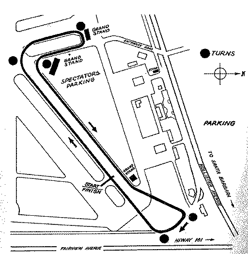
The aerial photos show the facilty some 30+ years after the airport was involved racing. The runway used for the course appears to have been taken out of service and dismantled in the interim. I have drawn an approximate course outline on the Google map.
For information on how these aerial images work, Click Here.
You may also wish to try using the Yahoo! Search as it may produce current news items.

This work is licensed under a Creative Commons Attribution-NonCommercial-ShareAlike 2.5 License.